North America Geographic Regions and Landforms

Watch North America Geographic Regions and Landforms

  • 2018
  • 1 Season

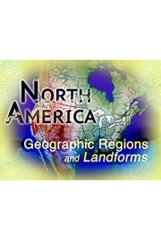
North America has 8 distinct geographic regions running north to south and extending east to west. This series examines the climate, soil, vegetation, animal life and landforms of each diverse geographic region. The human impact on the area is also discussed. Concise maps outline the location and size of each region and computer graphics help illustrate how notable geologic features are formed.

North America Geographic Regions and Landforms is a series that is currently running and has 1 seasons (6 episodes). The series first aired on January 1, 2018.

Filter by Source

Seasons
Coastal Range Geography
8. Coastal Range Geography
January 1, 2018
The Coastal Range stretches for over 3,500 miles, from the Alaskan Peninsula in the north, to the tip of the Baja California Peninsula in the south. This region is just a small part of a famous line of tectonic activity that circles the entire Pacific Ocean, known as The Ring of Fire!
Rocky Mountains Geography
6. Rocky Mountains Geography
January 1, 2018
The Rocky Mountains are like the backbone of the North American continent, stretched from top to bottom of the continent like a spine. In this case, the vertebrae are rugged mountain peaks. The true Rockies are found running from the Laird River Basin in the Canadian province of British Columbia to the Sacramento Mountains in the state of New Mexico, a distance of about 3,000 miles.
Great Plains Geography
5. Great Plains Geography
January 1, 2018
Between the Rocky Mountains and east of the Mississippi River, we find one of the continent's largest regional landforms, The Great Plains. Its most striking feature is its flatness and wide open spaces. The Great Plains encompass all or part of 15 of the United States and three Canadian provinces.250 million years ago it was a vast inland seaknown as the Western Interior Waterway.
Interior Lowlands Geography
4. Interior Lowlands Geography
January 1, 2018
The Interior Lowland of the North America is at the heart of the continent.This important region extends from the Canadian Arctic in the north to the Gulf of Mexico in the south.Location of many national geographic photos.The region features terrain with broad river valleys, rolling hills, high bluffs, forested growth, open vistas and many lakes.
Canadian Shield Geography
3. Canadian Shield Geography
January 1, 2018
The Canadian Shield has a greater land area with fewer people living in it than any other geographical regionon the North American continent.This geographic region has some of the hardest and oldest rocks to be found anywhere in North America. Scientists estimate there were at least 150 separate volcanic belts, or strings of volcanoes, involved in creating thefoundation of the Canadian Shield.
Appalachian Mountains Geography
2. Appalachian Mountains Geography
January 1, 2018
The Appalachian Mountains are the oldest mountain range in North America. They date back about 650 million years. The collision between the North American and African plates caused the mountain range to rise up. The Appalachians had become the highpoint of the eastern part of the continent, running from Newfoundland down to the central part of Alabama.
Description
Where to Watch North America Geographic Regions and Landforms
North America Geographic Regions and Landforms is available for streaming on the Film IdeasInc. website, both individual episodes and full seasons. You can also watch North America Geographic Regions and Landforms on demand at Amazon.
  • Premiere Date
    January 1, 2018